
Waterfront in Camden County: Four Waters, Four Purchases


In this post
- The county the water drew
- The Pasquotank: the western side
- The North River: the eastern side
- The Albemarle: the southern end
- The Dismal Swamp Canal: the corridor
- What the word waterfront does not tell you
- Permits, and the line that runs through this county
- The public water you don’t have to buy
- The part I tell buyers before they fall for a dock
The boots stay in the truck this time of year. Not for mud, though there is plenty of that. For the dew on a dock at eight in the morning, when the boards are slick and you are walking out to look at a river you have only seen from the road.
I did that walk last week off a lane near South Mills. The canal was flat and brown, cypress on the far bank turning rust, a heron working the edge like it had an appointment. Then I drove twenty minutes and stood on a bank above the Pasquotank where the wind was coming straight up the river and the water had white on it. Same county. Same price band, roughly. Two completely different lives.
That is the thing about waterfront in Camden County. There isn’t one water. There are four, and the word “waterfront” in a listing tells you almost nothing until you know which one.
The county the water drew
Camden was formed in 1777 out of Pasquotank County and named for Sir Charles Pratt, earl of Camden. It sits in the northeast corner of North Carolina, bordered in part by Virginia and by the Albemarle Sound, with farmland covering 33 percent of its acreage. The county seat dates to 1740, when it was called Plank Bridge. It became Jonesborough in 1792 and was Camden by 1840. South Mills, Belcross, and Shiloh are the other communities you’ll see on a plat map.
Look at the shape of it on a map and the reason for four waters becomes obvious. The county is a long, narrow block with the Pasquotank River down its western edge, the North River down its eastern edge, the Albemarle Sound closing off the southern end, and the Dismal Swamp Canal cutting across the top beside US 17. Water on three sides and a canal through the fourth.
Each of those four has its own current, its own depth, its own wind, and its own set of questions at closing.
The Pasquotank: the western side
The Pasquotank is the big water. It runs along the Camden side of the county line and opens into the Albemarle at the south end, so it is tidal and brackish, wide enough that a northwest wind can build a chop by mid-afternoon.
Buyers who want to be on a river with room to run a real boat gravitate here. Elizabeth City is close by water and by road, so fuel and a haul-out are not a production. The catch: this is working water as much as pleasure water. Commercial traffic runs it, the channel is marked, and the shoreline in places drops off faster than you’d guess from the bank.
What I ask on a Pasquotank parcel: where is the mean high water line on the survey, is there an existing pier and does its permit match what’s built, and how much of the bank is armored. A bulkhead that has been there forty years is a different asset than a bulkhead that has been there forty years and is now failing.
The North River: the eastern side
The North River is the one people misread. It looks like a creek from the road and behaves like a river when the wind gets up, and it draws a line between Camden and Currituck.
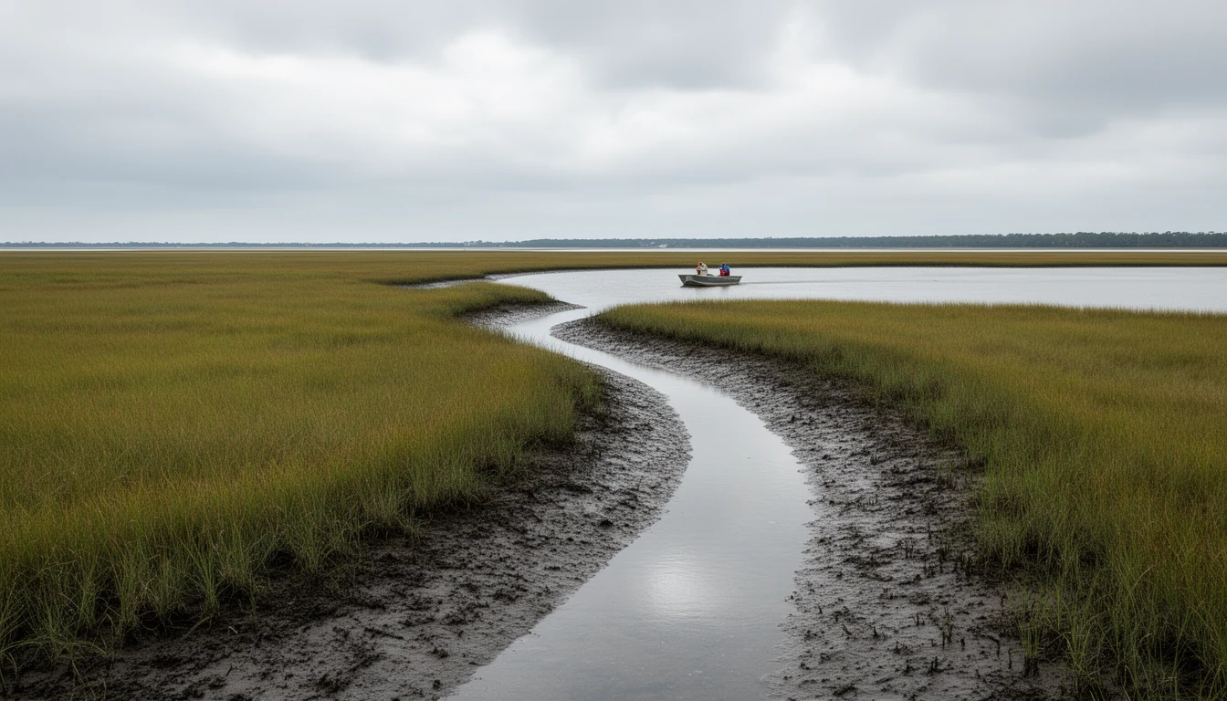
This is marsh country. Narrower water, softer banks, spartina and black needle rush, and a channel that moves. It photographs badly and it is gorgeous anyway, all horizontal and gray-green, and it is the water I’d pick personally. It is also the water where access questions get sharpest, because a lot that fronts marsh may front water you cannot practically get a boat into at low tide.
The North River is where I insist on a depth conversation before an offer. Not a seller’s memory of depth. A recent sounding, and a look at where the channel actually runs this year.
The Albemarle: the southern end
The sound is the third water, and it is the one with the most fetch. It is shallow and wide and open to the south and east, which means wind from those directions has miles to build before it reaches a shoreline at the bottom of the county.
Sound-front land is where you get the long view and the sunset. It is also where the insurance quote starts mattering more than the view, and where a dock is a much more serious structure than a dock on a creek. On a calm evening in October it is the best place in the county to stand. In a northeast blow in March it is not.
The Dismal Swamp Canal: the corridor
The canal is the fourth water, and the one that surprises people who move here from away. It was completed in 1805, runs 22 miles from Deep Creek, Virginia to South Mills, is about 50 feet wide and up to 9 feet deep, and was dug by hand with seven original locks. The American Society of Civil Engineers calls it the oldest surviving artificial waterway in continuous use in the United States. It is listed on the National Register of Historic Places and is an alternate route on the Atlantic Intracoastal Waterway, which is why you’ll see out-of-state transoms tied up at the welcome center in November.
Canal frontage is its own category. The water is flat, the current is managed by locks at both ends, and the experience of living on it is closer to living on a long, green lake than on a river. Slow boats and a lot of birds.
Here is the part that matters. Fronting the canal is not the same as having access to it. The canal runs beside US 17, and there are parcels where a county road or a railroad grade sits between the property and the water. I have seen listings labeled waterfront where the “water” was a drainage ditch on the other side of a state right of way.
What the word waterfront does not tell you
Six questions I ask on every Camden County water parcel, in roughly this order:
- Which of the four waters does this actually touch, and is the shoreline on the survey?
- Is the water navigable from this bank at low tide, and who measured it?
- Is there deeded access, a riparian right, or neither? A shared easement to a common dock is a different purchase than fee-frontage.
- Does the pier, ramp, or bulkhead have a permit on file, and does the as-built match the permit?
- Is any part of the lot in a flood zone, and what did the last insurance quote come back at?
- What is between the house and the water: a county road, a railroad, refuge land, or nothing?
None of those six is on a listing sheet. All six move money.
Permits, and the line that runs through this county
Camden is one of 20 North Carolina counties subject to the rules of the Coastal Resources Commission under the Coastal Area Management Act. That means development inside an Area of Environmental Concern may need a CAMA permit, and on waterfront lots the Area of Environmental Concern is usually the part you bought the place for.
Practically: a new pier, a bulkhead replacement, or shoreline stabilization on tidal water goes through a permit process, and the standards for a marsh bank are not the standards for a sand bank. Living shoreline designs have become more common on the North River side for exactly that reason. They also cost less than a bulkhead in most cases and hold up better in a blow.
The useful move during due diligence is to pull the permit history for the address. If a dock exists and no permit exists, that becomes a conversation with the county and the Division of Coastal Management, and it becomes one before closing rather than after.
The public water you don’t have to buy
One reason waterfront premiums in this county stay saner than they might: the public access is genuinely good, and a buyer who decides against a dock has real options.
The Dismal Swamp Welcome Center at 2356 US Highway 17 North in South Mills keeps a 150-foot face dock at Canal Milepost 28, open to boats and to cars, which makes it the easiest place in the county to put eyes on canal traffic without owning a thing. Dismal Swamp State Park next door at 2294 US 17 North has 21.5 miles of hiking and biking trails, a paddling access point, and boat rentals, with no camping on site. (The park’s phones have been out; staff answer at dismal.swamp@ncparks.gov.)
The Great Dismal Swamp National Wildlife Refuge covers parts of the county and protects roughly 113,000 acres, the largest intact remnant of a swamp that once ran past a million acres. A trailer and a launch pass will get you onto more water in a weekend than most dock owners use in a season.
The part I tell buyers before they fall for a dock
Camden County waterfront is not a resort. There is no grocery store on the water and no marina village. You are driving for milk. The bugs in July are a genuine factor and not a joke. Marsh views come with marsh smell at low tide, which some people love and some cannot get past. Peat smoke from a swamp fire can hang over the county for weeks, and it did in recent years.
Then the money side. Flood insurance on sound-front and low river-front land is not the same number as flood insurance ten miles inland, and it is not the same number between two lots on the same street if the elevations differ. Get the quote during due diligence, not after. A dock adds value and adds maintenance, and a forty-year-old bulkhead is a capital expense on a schedule you don’t control.
What you get for all of that is water you can be on in ten minutes on a Tuesday afternoon in October with nobody else out there. That trade is worth it to a lot of people. It should be a trade you choose on purpose.
Pick the water before you pick the house. Drive to the Pasquotank on a windy afternoon, then to the North River at low tide, then out to the sound, then up Canal Road past South Mills. They will sort themselves for you in about three hours.
Then bring me the address and I’ll pull the shoreline, the permit file, and the flood history. If the answers hold, you’ll know what you’re buying. If they don’t, you’ll know that too, and you’ll know it before you’re standing on a slick dock at eight in the morning.
Melinda Cabot is a broker with Horizon Realty Group in northeastern North Carolina. Figures here come from the sources listed above; permits and flood determinations are property-specific and should be confirmed with Camden County and the NC Division of Coastal Management.
Keep reading
The 1% Tax Most Camden Buyers Never See Coming
Camden is one of seven North Carolina counties levying a 1% local land transfer tax. What it costs, who pays it, and where it hides in a contract.
Camden's Tier 3 Move Cost It a Tax Credit
Camden County moved from Tier Two to Tier Three for 2026 — good news about the county economy, bad news for one specific historic rehab tax credit.
Camden Schools: The Numbers Behind the Grades
Camden County Schools earned zero D or F grades in 2024-25. Two of its five schools also came back growth Not Met. Both facts belong together.